The San Diego River Trail
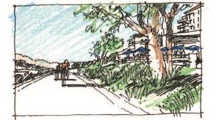 The San Diego River Park Conceptual Plan envisions a trail system from the mountains to the ocean. The main trail is called the San Diego River Trail, a multi-purpose trail and pathway for pedestrians, bicycles and other users. The vision of the River Trail includes equestrian users east/upstream of Mission Trails Regional Park into Santee, Lakeside and beyond. This connected system serves as the unifying thread for the San Diego River Park system and will offer recreational opportunities and access to park facilities and nature, in general.
NOTICES
none currently
PRIORITY PROJECTS
- West Valley Crossing - To extend the 3.75 mile estuary segment across the River to connect it and Sefton Park with Friars Road and the Mission Valley YMCA. Preliminary Engineering Report has been completed and the next step is a more detailed study. This has been identified as a top priority by the San Diego River Coalition.
- Cedar Creek Falls to El Capitan Dam - This would establish the trail from below El Capitan Dam to the existing trail to Cedar Creek Falls. Most of this trail is on National Forest Service lands. The River Park Foundation is partnering with the National Forest Service, County of San Diego and others to finalize an alignment. Discussions with the City of San Diego and at least one private landowner are required to place the trail on their property.
- Stadium - SANDAG has taken the lead to develop a temporary alignment for the River Trail across the Stadium parking lot. This will connect the existing end of the River Trail at Fenton Parkway to Ward Road. SANDAG has completed environmental work and design on this, and the project is funded. Discussions between SANDAG and the City are required in advance of starting construction.
- Mast Park West to West Hills Parkway and Mission Trails Regional Park- SANDAG has taken the lead on this project and has completed the environmental work required. It is unclear when this project will proceed to construction.
- Trail Improvements in Mission Valley: Protecting Crossing of Avenida del Este and completion of the proposed Discover Center at Grant Park. It is anticipated that construction of the crossing will commence in January 2018. The Discovery Center is in permitting.
UPDATES
A City of San Diego project is scheduled to start construction in 2018 to add lights under 163 to improve safety along Cam. de la Reina.
MORE INFO
The San Diego River Park Foundation advocates with funders, public agencies, landowners and other partners to complete the vision of the San Diego River Trail. In some cases, we will also be the lead to construct trail segments.
The vision of the River Trail is to match the character of the community or open space it is traversing. In the mountains, the trail width will be narrower matching the wilderness experience that is provided. In Misson Valley, it will be much more urban with pocket parks, public art and even cafes, all designed in harmony with the River's ecosystem. In the estuary, there will be view areas and interpretive signs to celebrate the incredible wildlife and history of the area. While the San Diego River Park system will be much more than the River Trail, the Trail is a critical piece that ties communities and recreational areas together.
MAPS
The River Trail can be divided into several sections, each at different stages of completion:
- Cedar Creek Falls Area - For map, click here
- El Capitan Reservoir Area - No public trails are currently available. Future trails are planned.
- El Monte Valley - A Comprehensive Trail Plan has not yet been developed. Some projects are underway.
- Lakeside River Park - For map, click here
- Santee River Park - For map, click here
- Mission Trails Regional Park: Several projects are anticipated, visit mtrp.org for trail information
- MTRP - Ward Road - Trails will be developed as private property is developed or redeveloped
- Ward Road to Fashion Valley Road - Known as the Mission Valley Greenway Initiative. For map, click here
- Fashion Valley Road to Sefton Park/Mission Valley YMCA - Current Gap
- Sefton Park/Mission Valley YMCA to Dog Beach: Known as the Estuary Section. For map, click here
* The above trail maps are not meant to be precise trail maps, but for illustration of existing and planned projects to complete the vision of the San Diego River Trail. For more detailed information contact The San Diego River Park Foundation.
The San Diego River Trail is a critical piece in the planned 52 mile-long San Diego River Park system. The trail will reflect the area it traverses from wilderness-type experience in the upper reaches to a more urban feel in Mission Valley. The trail system will also connect with existing and planned trails along its length. If you are interested in supporting this vision with your time, talents or funds, please contact the San Diego River Park Foundation to learn how you help complete the River Trail.

STAY INFORMED
Sign up for our Newsletter and get up to date information.Sign up today »

VOLUNTEER NOW
Help us keep the River beautiful for the next generation.Volunteer now »


